Pages - Pagina's

5 Apr 2012

From New Caledonia to New Zealand via Norfolk Island
Sunday 20 November until 1 December 2012

The departure from New Caledonia in the direction of New Zealand is a pleasant one. The sun is shining, the wind is not blowing from the wrong direction and there are no waves or swell to make life on board difficult. Exactly the weather that was predicted and we are surprised that the prediction is true. The surprise is short lived. Fortunately, the wind remains an easterly, but the wind speed should not exceed 15-20 knots, but it regularly exceeds 25 knots and the sea becomes unpleasant. Regularly we slide off a wave and get water in the gunwales and because we sail half wind we get a lot of spray in the cockpit. Nothing serious, but it is not really enjoyable. We decide that if things get worse we will turn around and go back. Fortunately it does not get any worse and so we muddle through. With this sea state, we can not point much higher as half wind, but that looks OK, because the bow points straight to Norfolk Island. Unfortunately we have a large side current, setting us to the southwest. We probably end up east of Norfolk when we follow this course. Nothing we can do about that. We can only hope that the weather improves and changes. And, incredibly, one day later, our hopes are realized: the wind decreases and turns to the north. Our dependable wind vane steers the boat nicely towards Norfolk island. The sea remains a bit rough with cross-waves, but one gets used to that. The weather maps show a developing low pressure area near the Australian coast, so we decide to make a stop in Norfolk. If the weather forecast had been more optimistic, we would have sailed straight on to New Zealand, but such a low in Australia always moves towards New Zealand with all the bad weather (rain and wind) that it implies. Norfolk does not have any all-weather anchorages, but if you keep an eye on the wind and move in time, it does not have to be unpleasant nor dangerous. When we get nearer to Norfolk we clearly notice that we have left the trade wind belt. The winds vary much more in direction and speed, and also very noticeable is the decreasing temperature. We do not need sweaters yet, but then we are not yet in New Zealand either! Thursday, 24 November the wind disappears completely early in the morning and we start the engine. Norfolk island stretches along the horizon and it is only another 17 nautical miles to the anchorage. Having sailed the last 374 nautical miles, using the engine for those last few miles is not an issue. The sail versus engine percentages in the past year have been a lot worse. We anchor in Sydney bay, the main bay of the island (Norfolk is small). The bay is surprisingly pleasant, something we had not expected in view of the prevailing winds of the last few days. There is a slight swell, but nothing to worry about and it has no deleterious effect on our sleep. In Norfolk, the weather can change rapidly, as we are going to experience ourselves. 
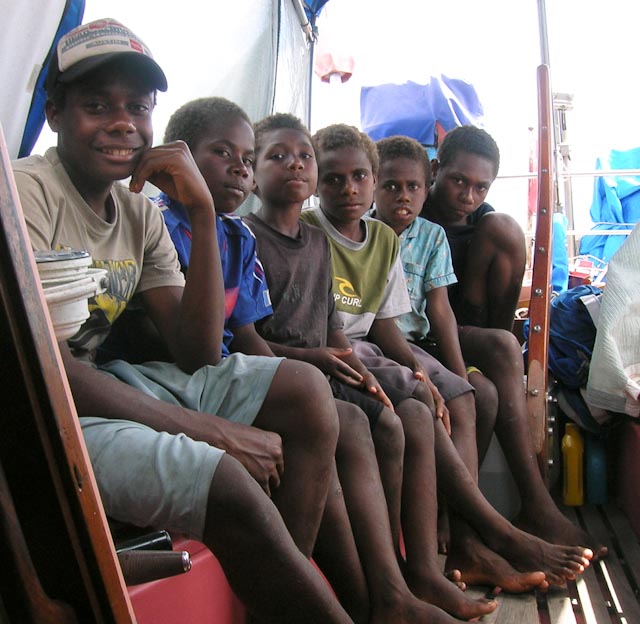
We arrive with another sailboat (French) and Joop gets a lift to the shore to clear customs, while Hanneke remains on board. 
Norfolk Island is Australian, but the attitude of the local customs is very different from the officials in the rest of Australia. The average Australian customs officer can best be described as a bastard (the women too), who try to make the life of a sailor as difficult as possible. Among the sailors circulate countless horror stories and quarantine officials are even worse. Not so on Norfolk. A sailor does not need to have a visa in advance and although they like it when you inform them that you might come, this is not obligatory. The customs people meet you at the pier and the few official papers are dealt with on the tailgate of the customs truck. The clearance is also given immediately, because the officer knows that the weather on and around his island can change so fast, that sailors could be forced to leave within one hour. One worry less, if all the paperwork is already in order. The whole procedure is free of charge and you can decide yourself, when you want to leave. We receive all kinds of information about the island including a sheet with the weather forecast for the next three days. What a service! Norfolk wins in our opinion the prize for the most pleasant immigration and quarantine handling. And as icing on the cake, everyone gets a lift to the center of the island to do some shopping and returned at the jetty an hour later. What a wonderful welcome.
Van Nieuw Caledonië naar Nieuw Zeeland via Norfolk eiland
Zondag 20 november 2011 tot 1 december 2012

Het vertrek bij Nieuw Caledonië richting Nieuw Zeeland is plezierig te noemen. De zon schijnt, de wind waait niet uit de verkeerde hoek en geen golven of deining om het leven aan boord te veronaangenamen. Precies wat het weerbericht voorgeschreven had en het verbaast ons een beetje dat het weer zich er ook aan houdt. De verbazing duurt niet lang. Gelukkig blijft het uit het oosten blazen, maar de windkracht die niet boven de 15-20 knopen uit zou mogen komen, schiet door tot boven de 25 knopen en de zee wordt onaangenaam. Regelmatig donderen we van een golf af en scheppen we water in het gangboord en omdat we halve wind varen krijgen we fledders water in de kuip. Niets ernstigs, maar het is niet zo plezierig. We besluiten dat als het allemaal nog erger wordt we omkeren en teruggaan. Gelukkig wordt het dat niet en dus modderen we door. Gezien de toestand van de zee kunnen we niet veel beter varen als halve wind, maar dat lijkt voldoende, want de boeg wijst recht naar Norfolk eiland. Helaas hebben we een forse zijstroom, die ons naar het zuidwesten zet. De resulterende koers dreigt ons ten oosten van Norfolk te laten uitkomen. Niets aan te doen. We kunnen slechts hopen op een weersverbetering en –verandering. En, niet te geloven, een dag later komt onze hoop uit: de wind neemt af en draait verder naar het noorden, met als gevolg dat onze beste brave windvaan ons keurig richting Norfolk begint te sturen. De zee blijft voorlopig nog even lompig, met kruisgolven, maar daar is aan te wennen. De weerkaarten laten een zich ontwikkelend laag zien bij de Australische kust en dus besluiten we definitief om bij Norfolk te stoppen. Als de weersverwachting optimisties geweest was, dan zouden we in één keer doorvaren naar Nieuw Zeeland, maar een dergelijk laag bij Australië drijft altijd richting Nieuw Zeeland met alle ellende (regen en wind) die daaraan vastzit. Norfolk heeft geen perfecte ankerbaaien, maar als je de windverachting in de gaten houdt en op tijd verhuist, hoeft het niet onaangenaam of gevaarlijk te zijn. Als Norfolk dichterbij komt beginnen we duidelijk te merken dat we de passaatgordel aan het verlaten zijn. De wind wordt draaieriger en vlageriger en, zeer merkbaar, de temperatuur begint te dalen. We hebben nog geen truien nodig, maar we zijn ook nog niet in Nieuw Zeeland! Donderdag 24 november valt de wind 's ochtends vroeg definitief weg en starten we de motor. Norfolk eiland vult dan al lang en breed de horizon en het is nog maar 17 zeemijlen tot aan de ankerplek. Na 374 zeemijl gezeild te hebben is het motoren van die laatste paar mijlen geen punt. De gemiddelde zeil/motor verhouding is het afgelopen jaar een stuk slechter geweest. We laten ons anker vallen in Sydney baai, de hoofdbaai van het eilandje (Norfolk is niet groot). De baai is verrassend kalm, iets dat we niet verwacht hadden met het oog op de heersende winden van de afgelopen dagen. Er loopt een lichte deining, maar niets verontrustends en het heeft ook geen funeste invloed op ons slapen. Bij Norfolk kan het echter snel veranderen en dat zullen we aan den lijve ondervinden. We arriveren samen met een andere zeilboot (Frans) en Joop krijgt een lift naar de kant voor het inklaren, terwijl Hanneke aan boord blijft. 
Norfolk eiland is Australisch, maar de houding van de lokale douane staat haaks op die van de beambten in de rest van Australië. De gemiddelde Australische douanebeambte kan het beste omschreven worden als een klootzak (ook de vrouwen), die het leven van een zeiler zo moeilijk mogelijk wil maken. Onder de zeilers doen legio gruwelverhalen de ronde en de quarantaine ambtenaren zijn nog erger. Zo niet op Norfolk. Een zeiler hoeft niet bij voorbaat een visum aangevraagd te hebben en ze vinden het fijn als je meldt dat je misschien komt, maar het is geen verplichting. De douane ontmoet je op de pier en de paar officiële papieren worden op de achterklep van de douane truck ingevuld. Het uitklaren wordt ook meteen geregeld, want de beambte beseft dat het weer op en rond zijn eiland zo snel kan veranderen, dat zeilers van het ene uur op het andere gedwongen kunnen worden om te vertrekken. En dan is het handig als de papieren al in orde zijn. De hele procedure is kosteloos en je mag zelf beslissen wanneer je wilt vertrekken. We krijgen allerlei informatie over het eiland overhandigd en daarbij is zelfs een velletje met het weerbericht voor de komende drie dagen. Wat een service! Norfolk wint wat ons betreft de hoofdprijs voor de meest schappelijke immigratie en quarantaine afhandeling. En als klap op de vuurpijl krijgt iedereen ook nog een lift naar het centrum van het eiland om wat boodschappen te doen en een uurtje later worden we weer teruggebracht. Norfolk kan niet meer stuk.
 Sydney Bay 
Sydney Bay

Sydney Bay

Two more boats anchor in the bay and rolling slightly we enjoy the environment and a whole night of undisturbed sleep. The next day all the sailors go ashore and together with another couple we rent a car for a day of sightseeing. As said, Norfolk is a spec of an island, but there is a lot to see. Everywhere along the coast there are spectacular views and it soon dawns on us why there are so few places where you can land safely.
Er ankeren nog twee boten in de baai en licht rollend genieten we van de omgeving en van een ongestoorde nachtrust. De volgende dag gaan alle zeilers naar de kant en samen met een ander stel huren we een auto voor de dag en scheuren het eilandje rond. Zoals gezegd, Norfolk is niet groot, maar er is een hoop te zien. Vooral langs de kust zijn er spektakulaire uitzichten en het wordt ons alras duidelijk, waarom er zo weinig plaatsen zijn waar je veilig aan land kan komen.
Anson Bay                                                     Anson baai

 Duncombe baai, with view of Cook point       Duncombe baai, met zicht op Cook point

 Cook Point    

Many rocks and very few beaches. And if there is a beach, there is almost always heavy surf, making a landing a very wet activity.
Veel rotsen en heel weinig stranden. En als er dan een strand is, dan is er bijna altijd wel een stevige branding, die van een aanlanding een zeer natte bezigheid maakt.
Anson Bay                                             Anson baai      


Even the two piers of the island (one bay in Sydney) cannot always be used, because of the wild seas. Both piers have a crane to lift the local fishing boats out of the water immediately after arrival.
Zelfs de twee pieren die het eiland rijk is (één ervan in Sydney baai), zijn vanwege de wilde zeeën, niet altijd bruikbaar. Beide pieren hebben een hijskraan om de lokale visbootjes direkt na het arriveren uit het water te hijsen.
 Cascade Bay, the pier                       Cascade baai, de pier       


We are really pleased that fellow sailor Christian ferries us and others ashore and later back again to our yachts. Saves us the hassle of inflating the dinghy and all kinds of exciting maneuvers at the pier. Besides enjoying the views, we visit the Bounty museum. Many of the islanders are direct descendants from the mutineers of the Bounty. Originally, these people found refuge on Pitcairn Island (on the other side of the Pacific ocean), but that was soon too small (these mutineers bred like rabbits) and the Australian government gave the descendents a chance to move to the almost empty and larger Norfolk island. 
By the end of the afternoon we discover what the effect of relatively small wind changes can be on this island. We pass Ball Bay (east side), where a German catamaran is bouncing up and down in the swell and we wonder why they do not move to Sydney bay. Why not becomes abundantly clear as we approach our bay: the same swell also rolls in and the four boats are rolling and pitching in the ground seas and jerking at their anchor chains.
We zijn dan ook blij dat medezeiler Christian ons en anderen naar de kant brengt en later weer terug naar de boot. Geen opblazen van bijboot en geen spannende manoeuvres bij de pier. Behalve genieten van de natuur, bezoeken we het Bounty museum. Een groot gedeelte van de eilanders stammen direkt af van de muiters van de Bounty. Oorspronkelijk hadden die een schuilplaats gevonden op Pitcairn eiland (aan de andere kant van de Stille oceaan), maar dat was al gauw te klein (die muiters fokten zich suf) en de Australische overheid gaf de afstammelingen de kans om te verhuizen naar het zo goed als lege en grotere Norfolk. 
Tegen het eind van de middag komen we er achter wat relatief kleine windveranderingen kunnen betekenen op dit eiland. We komen langs Ball baai (oost kant), waar een Duitse catamaran flink ligt te stuiteren op de binnenrollende deining en we begrijpen niet waarom ze niet verhuizen naar Sydney baai. Waarom net wordt snel duidelijk als we onze baai naderen: dezelfde deining rolt ook hier naar binnen en de vier zeilboten liggen in de grondzeeën te rukken aan hun ankerkettingen.
Sydney Bay, steep ground swells              Sydney baai, de grondzeeen zijn hoog

Clearly time to leave. As fast as possible, while avoiding the worst of the breaking seas Christian ferries everyone back to their boat and we are glad that we were checked both in and out yesterday. The Vaarwel is the closest to the shore and right behind us start the ground swells. Observing that is sufficient encouragement to anchor up quickly and leave. The boat is ready for sailing and within fifteen minutes we are underway together with the others, but where to? We have seen that the east bay is unsuitable, just as the north bay, where a big swell runs through it. Only Anse bay on the west coast is an option. We sail around the corner and after a few miles the swell diminishes, but surprisingly Anse bay is not very comfortable. A few locals, present on the pier, told us that just north of Anse bay, behind a small rocky point, the water is often a lot calmer. It seems unlikely that a few hundred meters and a tiny headland can make much difference, but it turns out they are right. A textbook example of local knowledge. This anchorage leaves something to be desired, because the bottom is mainly pebbles and rocks (poor holding) and we are anchored very close to the imposing cliffs.
Duidelijk tijd om te vertrekken. Op een holletje en zoveel mogelijk de brekers vermijdend brengt Christiaan iedereen terug naar hun boot en we zijn blij dat we gisteren in- en uitgeklaard zijn. De Vaarwel ligt het dichts onder de kant en vlak achter ons beginnen de grondzeeën te breken. Eén blik daarop is voldoende aanmoediging om snel anker op te gaan. De boot is nog steeds zeilklaar en binnen een kwartier zijn we onderweg, samen met de anderen, maar waarheen? We hebben gezien dat de oostbaai ongeschikt is, evenals de noordbaai, waar ook een stevige deining doorheen loopt. Anse baai dus, aan de westkust. We zeilen de hoek om en na een paar mijl begint de deining inderdaad te verminderen, maar verrassenderwijs is Anse baai niet erg komfortabel. Een paar lokalen, aanwezig op de pier, merkten op dat net na Anse baai, achter een klein rotspuntje de situatie vaak beter is. Het lijkt onwaarschijnlijk dat een paar honderd meter en een miniem kaapje zoveel verschil kan maken, maar het blijkt te kloppen. Een schoolvoorbeeld van lokale kennis van zaken. Helemaal OK is de ankerplek niet, want de bodem lijkt voornamelijk uit keien en rotsen te bestaan (slechte houdkracht) en we liggen wel erg dicht onder de imposante kliffen.
  Anson point, high cliffs behind Vaarwel        Anson point, hoge kliffen achter de Vaarwel

There is not much wind, nor is strong wind expected. We sleep reasonably well and early the next morning we set sail towards New Zealand. It is Saturday 26 November and there are no other ports en route. "Only" 550 nautical miles separate us from the beginning of the end of our 7.5 year journey. The beginning of the end, because after arriving at the northern tip of New Zealand we still have about 700 miles to sail before we reach our home in the Marlborough Sounds. The weather and the forecasted weather are pretty good. We are motor sailing in light winds more or less in the right direction and we have the engine going, because we need to maintain speed. After Tuesday, southerly winds are expected in New Zealand, thus it is important to get as far as possible before the wind change. Hanneke catches a tuna, delicious. Joop repairs the pump of the toilet, yuck, yuck. Fortunately, the sea is calm, otherwise the repair might have been much dirtier work or even impossible. In any case, the use of a bucket is avoided. For three days we make an average of over 110 miles per day, partly due to current. 
Then it is Tuesday and unfortunately for us the weather changes as predicted: there is a front bringing some drizzle and a wind shift to the south, but it is not very strong. In the evening the wind blows from the east and that is OK for us. The barometer is trending higher again and that should be a good sign (it indicates that we enter a high pressure area). On the weather maps we receive via the radio, there is a small dent in the isobars of this high precisely in the area where we are, northeast of the North Cape of New Zealand. We do not know whether that is significant. By Wednesday morning we experience first hand, those small innocent looking dents can have enormous influence on the weather. It's still dark when the wind increases to more than 25 knots, and before the end of the morning, we have an Easter storm with a constant wind speed of 30 to 35 knots and gusts to 40 knots. In no time we are confronted with steep high waves and it is impossible to stay on course toward Opua. This storm is also too much for our old, worn front sail: the cloth tears in places. Fortunately, the stitching holds the sail a bit together and we can still use a small section of the sail. With a third reef in the mainsail and the engine at low revs we battle on. But we cannot sail close enough to the wind, due to the very small front sail and the very rough sea. During the afternoon extrapolating our course would leave us stranded on the beach south of the northern tip of New Zealand. With the threat of running aground on a lee shore in sight of the harbor (Opua is less than 100 miles away from our position), we have to look at our options. We could sail back towards Norfolk, passing North Cape again and seek protection behind the west coast. However, the dangerous shoals that stretch far north of North Cape are also not very attractive, so we decide to persevere at the current heading. The headsail does not tear further and in the evening the wind veers slightly to the north. Just enough to enables us to head for Doubtless Bay, our alternative destination. In the end we get in quite easily. The night is eerily illuminated by runaway bush fires on the Karikari Peninsula. The storm does not help in fighting the fire. Close to the coast, the wind strength diminishes, and at dawn we enter the protected harbour of Mangonui.
Er is echter niet veel wind en er wordt ook geen krachtige wind verwacht. We slapen dus relatief goed en de volgende ochtend vertrekken we vroeg richting Nieuw Zeeland. Het is zaterdag 26 november en er zijn verder geen alternatieve havens onderweg. Nog "maar"550 zeemijlen scheiden ons van het begin van het einde van onze 7,5 jaar lange reis. Het begin van het einde, want na het arriveren bij de noordpunt van Nieuw Zeeland moeten nog ongeveer 700 mijl verder varen voor we thuis zijn in de Marlborough Sounds. Het weer en de weersverwachting zijn behoorlijk goed. We motorzeilen met lichte wind redelijk in de juiste richting en de motor doet mee, omdat we snelheid moeten houden. Na dinsdag worden er zuidelijke winden verwacht bij Nieuw Zeeland en het is dus zaak om voor die tijd zo ver mogelijk te komen. Hanneke vangt een tonijntje, lekker en Joop repareert de pomp van het toilet, bah vies. Gelukkig is de zee kalm anders had de reparatie nog veel viezer kunnen zijn of onmogelijk om uit te voeren. In ieder geval is het gebruik van een emmer vermeden. Drie dagen lang maken we een gemiddelde van ruim 110 mijl per dag, geholpen door stroom mee. 
Dan is het dinsdag en helaas begint de weersvoorspelling uit te komen: er komt een front over met wat miezerregen en de wind draait naar zuidelijke richtingen, maar wordt niet echt krachtig en 's avonds waait het uit het oosten en dat is goed genoeg voor ons. De gedaalde barometer loopt weer op en dat zou een goed teken moeten zijn (het geeft aan dat we een hoog invaren). Op de weerkaarten die we ontvangen is een klein deukje in de isobaren van dit hoog in het gebied waar we nu zijn, ten noordoosten van de noordkaap van Nieuw Zeeland, maar of dat iets te betekenen heeft weten we niet. In de loop van de woensdagochtend komen we erachter dat kleine onschuldig uitziende deukjes enorme invloed op het weer kunnen hebben. Het is nog donker als de wind begint toe te nemen tot boven de 25 knopen en voor het einde van de ochtend hebben we oosterstorm met een konstante wind van 30 tot 35 knopen en regelmatig uitschieters van 40 knopen. In korte tijd worden we gekonfronteerd met hoge steile golven en het blijkt onmogelijk om op koers te blijven richting Opua. Deze storm blijkt teveel voor ons oude, versleten voorzeil: het scheurt uit zijn lijken! Gelukkig houdt het stiksel het zeil nog een beetje bij elkaar en daardoor kunnen we een klein puntje ervan nog gebruiken. Met het derde rif in het grootzeil en de motor bij ploeteren we verder, maar door het gebrek aan voorzeil en de formidabele zeeën kunnen we niet scherp genoeg zeilen. Gedurende de middag dreigt onze koers ons zelfs op het strand ten zuiden van de noordpunt van Nieuw Zeeland te laten belanden. De dreiging van een dergelijk stranding aan lager wal in het zicht van de haven (Opua is minder dan 100 mijl van onze positie verwijderd), maakt het noodzakelijk om te overwegen om terug te varen richting Norfolk, de noordkaap weer te passeren en achter de westkust bescherming te zoeken. Echter, de gevaarlijke ondiepten die zich tot ver ten noorden van noordkaap uitstrekken zijn ook niet erg aantrekkelijk en dus besluiten we door te zetten. Het voorzeil scheurt niet verder en 's nachts draait de wind iets naar het noorden, waardoor we ons alternatieve doel, Doubtless Bay, uiteindelijk vrij ruim kunnen halen. De nacht wordt spookachtig verlicht door uit de hand gelopen bosbranden op het Karikari schiereiland. De stormwind helpt niet bij het bestrijden van het vuur. Onder de kust neemt de wind in kracht af en bij het eerste daglicht lopen we de beschermde haven van Mangonui binnen.
River entrance at Mangonui                      De rivier bij Mangonui              

We made it, we are in New Zealand, but what a homecoming! We anchor in calm water and immediately go to sleep for three hours, before cleaning up the outside and inside of the boat. A lot of water leaked in on this trip.
We hebben het gehaald, we zijn in Nieuw Zeeland, maar wat een thuiskomst! We ankeren in heerlijk kalm water en slapen eerst drie uur, alvorens de natte boel buiten en ook binnen op te ruimen. Er blijkt flink wat gelekt te hebben.

23 Dec 2011

New Caledonia
28 October till 20 November 2011
Finally the wind cooperates. Near Tanna it is a little confusing: first enough wind, then too little wind for a while. However, once out of the influence of Tanna it starts blowing a decent 15 to 20 knots from the east. We stop the engine, set the wind vane and are sailing without the sound of the electric autopilot for a change. The trip is quiet and unspectacular. Just the way we like it. We can sail most of the way and only close to New Caledonia disappears the wind and do we start the engine.
As usual we try to catch a fish, so we troll a fishing line behind the boat. As the oceans and seas are mainly fished out, we often drag two lines to increase our chances. One line with a lure resembling a fish and the other with an imitation squid. Halfway Joop notices that we caught a fish on the squid line. To prevent the two lines from tangling, Hanneke hauls in the "empty" line. To our surprise there is also a fish on this line! A Spanish mackerel one meter in length.
Nieuw Caledonië
28 October tot 20 November 2011

Eindelijk werkt de wind met ons mee. In de buurt van Tanna doet-ie nog een beetje raar: eerst voldoende wind, dan te weinig wind en zelfs even tegen. Echter, als we de invloed van Tanna achter ons gelaten hebben, waait er een keurige 15 – 20 knopen uit het oosten. Halve wind en dus gaat de motor uit, de windvaan ingesteld en we zeilen weer eens zonder het geluid van de elektriese autopiloot. De tocht is rustig en weinig spektakulair. Zo zien we het graag. We kunnen het grootste deel zeilen en pas in de buurt van Nieuw Caledonië valt de wind weg en moet de motor weer gestart worden.
Zoals gewoonlijk proberen we een vis te verschalken onderweg en daarvoor slepen we een lijn achter de boot. Aangezien de oceanen en zeeën grotendeels leeggevist zijn slepen we vaak zelfs twee lijnen tegelijkertijd om onze kansen te vergroten. De ene lijn met een nepvis als aas en de andere met een nep pijlstaart inktvis. Halverwege de tocht konstateert Joop dat we beet hebben aan de inktvislijn. Om de lijnen niet in elkaar te laten draaien, haalt Hanneke de andere lijn voor alle zekerheid eerst naar binnen. Tot onze stomme verbazing zit daar ook een vis aan! En geen kleintje: een spaanse makreel van een meter lengte.


These fish are not fighters, but this hardly resists: he or she must be about dead immediately after it was caught, when the hook caught in their mouth. Just to be sure we pour some alcohol in the gills, but it is not really necessary. Rope around the tail and we simply pulled on board. Then we check the other line, it is still moving back and forth behind the boat. This fish still has enough life in it. It is a mahi-mahi (dolphin fish), also with a length of 1 meter. Although this one is our favourite for eating, what are we to do with two big fish and no refrigerator? We decide to release the mahi-mahi, but how do we get the hook out of a mouth full of sharp teeth. We are lucky. As we pull the fish alongside, it turns around and throws the hook. Gone is the fish, thank goodness. The first time we are happy to lose a fish.
Access to the southern lagoon around New Caledonia is through the Havana passage. According to the boating guide, you should not pass it against the current, because a) it is terribly slow (the current is 3 to 4 knots) and b) even with a moderate sea there are steep groundswells. We aim for the correct the transit time with the information we have (we even slow the boat somewhat) and found the timing turned out to be wrong. Instead of the current with us, we have it against and although the swell is quite low, we are surrounded by triangle shaped standing waves. We turn up the engine until we are through the passage. Clearly our information was incorrect.
Dit zijn geen vechters, maar deze heeft het wel erg bont gemaakt: hij of zij moet zo ongeveer onmiddellijk het loodje gelegd hebben, toen de haak in zijn of haar bek bleef steken. Voor alle zekerheid gieten we wat alkohol in de kieuwen, maar echt nodig is het niet. Touw om de staart en simpelweg aan boord getrokken. Dan de aandacht verlegt naar de andere lijn, die gezellig achter de boot heen en weer zwiept. De vis, die daar aan zit heeft nog genoeg leven in zich. Het blijkt een mahimahi (goud makreel) te zijn, ook met een lengte van 1 meter. Weliswaar onze favoriete eetvis, maar wat moeten we met twee joekelige vissen en geen koelkast. We besluiten de mahimahi de vrijheid te geven, maar hoe krijgen we de haak uit een bek vol scherpe tanden. We hebben geluk. Op het moment dat we de vis langszij trekken draait die zich rond en daardoor schiet de haak los. Weg vis, wij blij. De eerste keer dat we blij zijn om een vis te verspelen.
De toegang tot de zuidelijke lagune rond Nieuw Caledonië leidt door de Havanna passage. Volgens de vaargids moet je dat niet doen met stroom tegen, omdat a) je dan vreselijk langzaam gaat (de stroomsterkte bedraagt 3 à 4 knopen) en b) bij zelfs gematigde deining er gemene steile grondzeeën ontstaan. We mikken de passagetijd zo perfekt mogelijk met de info die we hebben (we vertragen de boot zelfs wat) en blijken het uiteindelijk behoorlijk mis te hebben. In plaats van stroom mee, hebben we stroom tegen en ondanks dat de deining vrij laag is zijn we omringd door staande driehoekgolven. We zetten de motor harder en zijn binnen voordat de stroming zijn hoogtepunt bereikt, maar kunnen wel concluderen dat onze info van geen kanten klopt.

Our first impression of south New Caledonia is not positive. There seems to be much erosion on the coast and there grows surprisingly little. The bright red clay is photogenic, but does not seem very fertile. Most erosion, we read, is a natural phenomenon, but mining for nickel has not improved the situation. We find a quiet anchorage in the Bay of Prony with more examples of erosion as well as scruffy looking Norfolk pines.
Onze eerste indruk van de zuidkant van Nieuw Caledonië is niet erg gunstig. Er blijkt veel erosie te zijn langs de kust en er groeit maar weinig. De knalrode klei is wel fotogeniek, maar lijkt niet erg vruchtbaar. De meeste erosie, zo lezen we, is natuurlijk, maar de mijnbouw (nikkel) heeft de situatie niet verbeterd. We vinden een kalme ankerplaats in de Prony baai met nog meer voorbeelden van spektakulaire erosie.

We need to clear customs in the capital Noumea and sail there in two day trips. The stop at bay of Ngo shows us how badly the landscape can be affected by mining. At least the rock has beautiful colours.
We moeten voor het inklaren naar de hoofdstad Noumea en varen daar in twee dagtochten heen. De stop in Ngo baai laat ons zien wat het landschap aangedaan kan worden door de mijnbouw. Mooie kleuren dat wel.

Noumea is a large city for the Pacific, but to our European eyes no more than a provincial town. Spacious wide roads with a lot of traffic (especially during rush hour) and a very French atmosphere. Our planning is all wrong again, because instead of arriving at the end of a normal weekend, we arrive in the middle of an extra long weekend (until Tuesday). By staying one day in the marina, we can check in immediately and use the opportunity to clean ourselves and the boat, do the laundry by hand and fill our water tanks. The next day we anchor the Vaarwel in the bay of Noumea. This bay is quite large, but the number of yachts and motorboats is incredible, there is no room for visiting yachts. The next few days we explore Noumea, eat French stick bread with very affordable Emmental cheese, stock up on stores subject to affordability, clear the country and leave. This is the official start of the trip to New Zealand, but we do not really depart yet. We plan to stop at Ile des Pins (the southern most anchorage of New Caledonia) and wait there for the right weather window. That is allowed. And how long should we wait? As long as it takes to get the right wind. This is how we and all other sailors like it: customs and immigration officials who understand how sailboats are affected by the weather.
Isle des Pins is located southeast of Noumea and so we head for the umpteenth time against the prevailing wind direction. Going to the southeast will continue until (and in) New Zealand, but near Norfolk Island at long last the trade winds disappear. We have no objection against that.
With the trip to Isle des Pins we are lucky: the wind is light and the angle OK. In two easy day trips we get there. Just before we reach the anchorage we catch a 6.5 kg tuna and we heave the fish on board just before we negotiate the reefs. Good timing. We organize a potluck dinner on the beach with the other yachties, who all help us eat the tuna.
Noumea is, voor stille oceaan begrippen, een grote stad, maar in onze europese ogen niet meer dan een provinciestadje. Ruim opgezet, brede wegen en behoorlijk wat verkeer (vooral in de spits) en heel frans aandoend. Onze planning faalt wederom, want in plaats van te arriveren aan het eind van een normaal weekend, arriveren we middenin een extra lang weekend (vrij t/m dinsdag). Door een dag in de marina te gaan liggen, kunnen we toch inklaren en nemen we meteen de kans waar om onszelf en de boot goed schoon te maken, de was met de hand te doen en de watertanks te vullen. Daarna ankeren we weer in de baai van Noumea, best lastig om een plekje te vinden. De baai is best groot, maar het aantal zeilboten en motorjachten is dat ook. Een paar dagen lang verkennen we Noumea, eten ons klem aan stokbrood en zeer betaalbare emmentaler kaas, vullen onze voorraden aan voor zover nodig en betaalbaar en klaren dan uit. Dit is het moment dat de tocht naar Nieuw Zeeland officieel begint, maar niet echt. Het is de bedoeling om te stoppen bij Ile des Pins (de zuidelijkste ankerplek van Nieuw Caledonië) en daar het juiste weerssysteem af te wachten. En dat is toegestaan. En hoe lang mogen we daar wachten? Zo lang als nodig is om de wind uit de juiste richting te laten waaien. Zo zien wij (en alle andere zeilers) het graag: douane en immigratie die begrijpen hoe dat zit met zeilboten.
Ile des Pins ligt in zuidoostelijke richting van Noumea en dus moeten we voor de zoveelste keer tegen de heersende windrichting in. Dat naar het zuidoosten varen zal blijven tot aan (en in) Nieuw Zeeland, maar al voor Norfolk eiland gaan de passaatwinden verdwijnen. Daar hebben we geen bezwaar tegen.
Met de tocht naar Ile de Pins hebben we mazzel: de wind is licht en uit een niet al te ongunstige hoek. In twee makkelijke dagtochtjes zijn we er. Vlak voor we ons doel bereiken slaan we een 6,5 kg zware tonijn aan de haak en we hebben het visje in het gangboord voor we op de riffen lopen. Keurig gedaan. We organiseren meteen een "potluck" avondmaaltijd op het strand, zodat de andere zeilers ons kunnen helpen om deze tonijn op te eten.


We anchor in Kuto bay and only 15 days later do we pull the anchor out of the white sand again. It took that long before we consider the forecasted weather suitable for sailing to New Zealand. But we are not bored for a moment: there is plenty to do on this island, the anchorage is a tropical delight with a white sandy beach and the weather is generally beautiful (= sunny but not too hot and low humidity). There is even French stick bread, so what more could one want. Well, uh, maybe some fresh vegetables and fruit. This island has not much fresh produce, at least not in the shops. A few pathetic cabbages and very expensive onions, that's about it. However, the papaya grows in the wild here, thus Joop saws a long bamboo pole and we regularly go papaya hunting. On board we have plenty cabbage, pumpkin and canned food.
We ankeren in de baai van Kuto en pas 15 dagen later trekken we het anker weer uit het witte zand. Zo lang duurt het voor we de tijd rijp achten voor de oversteek naar Nieuw Zeeland. Maar we vervelen ons geen moment: er is genoeg te doen op dit eiland, de ankerplek is zo'n tropiese verrassing met een wit zandstrand en het weer is over het algemeen schitterend (= zonnig, maar niet te warm en lage luchtvochtigheid). Er is zelfs stokbrood, dus wat wil een mens nog meer. Wel, eh, misschien wat verse groente en fruit. Daarvan hebben ze op dit eiland niet echt veel, althans niet in de winkels. Wat zielige kool en buitengewoon dure uien, dat is het zo’n beetje. De papaja groeit hier echter in het wild en dus zaagt Joop een lange bamboe stok, zodat we regelmatig op papaja jacht kunnen en verder hebben we genoeg kool, pompoen en blikvoer.
There are many footpaths on the island and given the pleasant climate, we enjoy climbing the hills and go for long walks. We suffer from muscle pain and shortness of breath, because for unknown reasons, our physical condition is not any more what it used to be. Of course we climb the highest "mountain" of the island (Pic Nga, about 300 m), where we have a nice view over Ile de Pins. There are even two different paths to the top and therefore we can take an alternative way down, which in turn yields different views.
Er zijn allerlei wandelpaden uitgezet op het eiland en gezien het plezierige klimaat is het weer mogelijk om heuvels te beklimmen en lekker lange stukken te lopen. Al deze inspanning veroorzaakt wel wat spierpijn en gehijg, want om onduidelijke redenen is onze fysieke konditie niet meer helemaal wat het geweest is. Natuurlijk beklimmen we de hoogste “berg” van het eiland (Pic Nga, ruim 300 m), vanwaar we een mooi uitzicht hebben over heel Ile de Pins. Er blijken zelfs twee verschillende paden naar boven te zijn en dus kunnen we een alternatieve weg naar beneden nemen, wat weer andere vergezichten oplevert.

Joop decides for the ultimate experience and find out how fast he can climb this molehill by hiking up again, but in the reverse order. We walk to other beaches and bays, and it is obvious that we are in a different climate zone by now. No more the tropical rainforests with its exuberant vegetation. The island looks more like a savannah, and that is consistent with the crisp dry air and the associated clear views.
Joop besluit om de ervaring totaal te maken en uit te vinden hoe snel hij deze molshoop kan beklimmen, door nog een keer naar boven te gaan, maar dan in omgekeerde volgorde. We wandelen ook naar andere stranden en baaien en al dit geloop door de bossen toont ons overduidelijk, dat we hier in een andere klimaatzonen beland zijn. Niks tropiese regenwouden met zijn uitbundige begroeiing. Het eiland doet meer denken aan een savanne en dat klopt ook met de heldere droge lucht en de daarmee samenhangende scherpe vergezichten.
Pleasant conditions for tourists and this is by far the main source of income for the islanders. Several times a week a cruise ship arrives in Kuto bay and their tenders ferry the passengers to the shore and back all day. The majority are Australians, but there are also boatloads of Asians, Europeans and Americans. After a visit to the boutiques many flop down on the white beach surrounding the bay and they do not venture any further. Given the size of many of these tourists it is probably for the best. Especially among the Australians there are very many fat people. It is obvious that the food and drink served on board is equally important as the destinations on a cruise.
Allemaal plezierige omstandigheden voor toeristen en dat is dan ook verreweg de belangrijkste bron van inkomsten voor de eilandbewoners. Regelmatig (een paar keer per week) ligt er een cruiseboot voor anker en varen veerbootjes een dag lang heen en weer om de passagiers naar de wal en terug te brengen. De meerderheid is Australiërs, maar er zijn ook bootladingen Aziaten, Europeanen en Amerikanen. Na een bezoek aan de strandboetiekjes ploffen velen neer op het witte strand van de baai en komen ze niet verder. Gezien de omvang van veel opvarenden is dat waarschijnlijk ook het beste. Vooral onder de Australiërs zijn er toch wel erg veel dikke lui bij. Het is duidelijk, het eten en drinken aan boord is minstens zo belangrijk als de bestemmingen van de cruise.


The whole time we were in Kuto bay we have four large remora fish under the boat. Every time we throw organic waste overboard, they emerge to nibble. These animals eat everything: vegetables, fruit and fish waste disappears inside if it's soft enough. The outlet of the toilet is also a favourite! While cleaning the hull Joop discovered that they fix themselves to the keel with the suction cup on their heads and hang there neatly side by side, waiting for what's being thrown overboard.
One day we walk along the road to Vaio, the capital of the island. Although walking is not quite the correct word to use, as we get a lift almost immediately. We happily accept. We walk the road back (7km) during the lunch break, when there is virtually no traffic. A bit of French influence. Lunch is sacred and most businesses and shops close between 11:30 and 14:30 and everybody goes home to enjoy a long hot lunch.
De hele tijd dat we in de Kuto baai liggen hebben we een viertal grote remora vissen onder de boot, die telkens als we organies afval overboord zetten, tevoorschijn komen om het op te peuzelen. Die beesten eten alles: groente-, fruit- en visafval verdwijnt naar binnen (als het maar zacht genoeg is) en ook de uitlaat van het toilet is favoriet! Bij het schoonmaken van de romp ontdekt Joop dat ze zich met de zuignap op hun kop vastzetten aan de kiel en daar keurig naast elkaar hangen, wachtend op wat er allemaal overboord gezet wordt.
We lopen langs de weg naar Vaio, de hoofdplaats van het eiland. Alhoewel lopen niet helemaal het juiste woord is: voor we Kuto goed en wel achter ons gelaten hebben, krijgen we spontaan een lift aangeboden. Iets wat we niet afslaan. De terugweg (7km) wordt wel te voet gedaan, want dat doen we gedurende de middagpauze en dan is er zo goed als geen verkeer. De franse invloed. Het middagmaal is heilig en dus zijn de meeste bedrijven en winkels gesloten tussen 11:30 en 14:30 en zit iedereen thuis om uitgereid te tafelen.
Frequently we discuss the weather forecasts with the other sailors, who are also waiting for a suitable high pressure area in the Tasman sea to sail to New Zealand. On Sunday 20 November the weather is finally right to have a pleasant sail, at least as far as Norfolk Island. We weigh the anchor and with at least 20 Ile de Pins papayas on board we sail through the pass and point the bow to the southeast.
Regelmatig bediskusiëren we de weerpatronen met de andere zeilers, die net als wij liggen te wachten op het juiste hoogdruk gebied in de Tasman zee, om naar Nieuw Zeeland te varen. Op zondag 20 november lijkt het moment eindelijk gekomen om op plezierige wijze, in ieder geval tot aan Norfolk eiland te kunnen komen. We gaan anker op en met ruim 20 Ile de Pins papaja’s aan boord varen we de pas door en wenden eens te meer de steven in zuidoostelijke richting.

7 Dec 2011

Finally back in New Zealand

We arrived in the Bay of Islands in the north of New Zealand on Saturday afternoon 3 December. We left New Caledonia on Sunday 20 November with easterly winds for the 900 mile passage. The seas were quite confused, but after a day the sea calmed down and we had a good sail to Norfolk island, which is nearly halfway to New Zealand. We stopped there on Thursday to wait for northeasterly winds. There were 5 yachts that day in Sydney Bay, a lot of boats for Norfolk island. The next day we all went ashore for some sightseeing, all very pleasant, but when we came back at 4 in the afternoon, the wind had shifted to the southeast and the waves were rolling into the bay. We all had to leave in a hurry and hide behind Anse point on the north side of this little island, where it was quite calm and we could stay the night. Next morning everybody left for New Zealand.
All went well the first four days after leaving Norfolk (sat 26 Nov), but less than 100 miles from the Bay of Islands we sailed into a storm with 30 to 35 knot easterly winds and rough seas. We were pushed towards the NZ coast, but managed to sail into Doubtless Bay during the night and by first light on Thursday 1 Dec we anchored just inside the Mangonui River, well protected from the wind and the waves. The next day the storm had passed and we continued to Whangaroa Harbour and on Saturday completed the last leg to Opua in the Bay of Islands.
We did receive a drubbing down from customs and quarantine, because we had not followed procedures (we should have asked permission for anchoring at Mangonui and flown the yellow flag), but in the end we were allowed back into the country.
Eindelijk terug in Nieuw Zeeland

Op zaterdag 3 december zijn we aangekomen in de Bay of Islands in het noorden van Nieuw Zeeland. Op zondag 20 november waren we vertrokken uit Nieuw Caledonie met oostelijke wind voor de 900 zeemijl lange oversteek. De zee was verward, net een wasmachine, maar na een dag waren de golven een stuk lager en we hadden een plezierige zeiltocht naar Norfolk eiland, bijna halverwege naar Nieuw Zeeland. We ankerden daar op donderdag om noordoostelijke wind af te wachten. Er waren die dag 5 jachten in Sydney Bay, topdrukte voor Norfolk eiland. De volgende ochtend vertrok iedereen naar Nieuw Zeeland.
De eerste 4 dagen na ons vertrek uit Norfolk (zaterdag 26 nov) gingen goed, maar met minder dan 100 zeemijl te gaan naar de Bay of Islands kwamen we in een storm terecht met oostelijke wind van 30 tot 35 knopen en een ruwe zee. We werden rechtstreeks naar de kust van NZ geblazen, maar gelukkig konden we in de nacht Doubtless Bay binnenzeilen en bij zonsopgang (donderdag 1 dec) ankerden we in de Mangonui rivier, goed beschermd tegen de wind en golven. De volgende dag was deze storm weer voorbij en gingen we verder naar Whangaroa harbour en op zaterdag het laatste stuk naar Opua in de Bay of Islands. 


We werden stevig onderhouden door douane en quarantine, omdat we ons niet aan de regels hadden gehouden (we hadden toestemming moeten vragen voor het ankeren in de Mangonui rivier en we hadden de gele vlag moeten h
eisen), maar uiteindelijk werden we toch weer toegelaten.

17 Nov 2011

From Efate to Tanna
10 to 28 October 2011

The weather (wind) prediction is spot on and on a flat calm sea, we motor through the night to Dillon Bay in Erromango. For a change we have a full moon and combined with a cloudless sky it means that we can see a lot more without the cockpit lighting turned on. If we are lucky, we have the moon till New Caledonia. We do want to sail to New Caledonia and that must certainly be possible, because by going to Erromango, we are now to the east of New Caledonia and to get there the course is west of south. With the prevailing eastsoutheast wind we can sail half wind, a very pleasant sailing angle. It is all going to work out that way, but much later than we planned. By that time the full moon has shrunk to a sliver.
In Dillon bay we are joined by another Dutch yacht, Nije Faem, and together with Paul and Mariëtta we explore the village and the surrounding area.
Van Efate naar Tanna
10 tot 28 oktober 2011

De weers- (wind-)verwachting krijgt helemaal gelijk en over een spiegelgladde zee moteren we 's nachts naar Dillon Bay in Erromango. We hebben voor de verandering nu eens volle maan en dat gekombineerd met een wolkenloze hemel betekent dat we een hoop meer kunnen zien, zonder de kuipverlichting aan te doen. Met een beetje geluk houden we dit tot Nieuw Caledonië. Wel willen we de rest van de tocht zeilen en dat moet ook kunnen want door eerst naar Erromango te gaan zijn we oostelijk van Nieuw Caledonië gekomen, zodat de koers erheen west van zuid is. Met de heersende oostzuidoostelijke wind is dat halve wind en dat is plezierig om te zeilen. Deze planning gaat uiteindelijk werken, maar wel veel later als dat we denken. Zoveel later, dat als de volle maan allang weer verdwenen is.
In Dillon baai liggen we samen met een ander nederlands jacht, Nije Faem, en samen met Paul en Mariëtta verkennen we het dorpje en de omgeving.
For us this is our second visit. We were here also seven years ago. The village has become slightly more prosperous (corrugated iron has replaced the traditional palm leaf roofs), but otherwise little has changed. The women still do the laundry in the rocky section of the river and the post office still looks picturesque.
Voor ons is dit de tweede keer, we lagen hier zeven jaar geleden ook. Het dorp is iets welvarender geworden (te zien aan de niet traditionele golfplaten daken), maar voor de rest is er weinig veranderd. De was wordt door de vrouwen nog immer in het van vele rotsblokken voorziene deel van de rivier gedaan en het postkantoor ziet er nog steeds pittoresk uit.


The river and its surroundings are still as beautiful as in our memories.
Ook de rivier en de omgeving zijn nog steeds even fraai als in onze herinnering.
Chief William, who seven years ago showed us the burial caves with the remains of the ancestors, has just retired and been succeeded by his son. He had big plans for his village and for the island, but it did not happen yet. What is becoming a reality are David's plans, another villager we met again. When He explained to us seven years ago, that he wanted to build a yacht club, we did not expect that to happen. But he started and there is now a two-storey building of considerable size under construction, surrounded by beautifully landscaped gardens
Dorpshoofd William, die ons 7 jaar geleden de knekelgrotten met de resten van de voorvaderen liet zien, is net gepensioneerd en opgevolgd door zijn zoon. Hij had toen grootse plannen voor zijn dorp en voor het eiland, maar die lijken niet helemaal uitgekomen. Wat wel lijkt uit te komen en dat is een verrassing, zijn de plannen van David, een andere dorpsbewoner die we indertijd spraken. Toen verklaarde hij ons, dat hij een jachtklup wilde bouwen en dachten wij op onze beurt, dat daar wel niets van terecht zou komen. Maar zowaar: er staat nu een twee verdiepingen tellend gebouw van behoorlijke afmeting omgeven door fraai vormgegeven tuinen.
The yacht club under construction     De toekomstige jacht club                     
Let's hope there are many yachts who will visit Erromango and the yacht club in Dillon Bay in the future. It is a good stopover, the bay is fairly protected and comfortable, with good holding in sand, and a nice view at forested hills.
Nu maar hopen dat er ook veel jachten gaan komen als de klup helemaal afgebouwd is. En waarom ook niet, de baai is redelijk beschermd en komfortabel, goede zandgrond om te ankeren en een fraaie omgeving om over uit te kijken.
I already alluded to the fact that we had some trouble with the next leg of our trip to New Caledonia. We exceeded our record of aborted starts. It stood at two (Madeira, 1991) and now stands at 3.5. That half is a bit peculiar, but will be explained in the next paragraphs.
On October 13 we do our first attempt to sail to New Caledonia. There is wind, that is certain, and the weather maps do suggest that perhaps the wind is too much from the south and maybe too strong. In Dillon Bay there is little wind, so we venture out. Once we inch past the southern cape of Erromango we are hit by 25 knots of wind, but it might be the effect of the cape so we persevere. Indeed, the wind moderates in the lee of Tanna, and the sailing is enjoyable, despite the fact that the wind is from the south. By one 'o clock we sail out of the lee of Tanna. The wind speed increases, the direction remains south, while a current pushes us west. Even sailing clause hauled we can not hold our course. We battle on, but two hours later under deteriorating conditions, we give up, turn around and sail back. The return journey is very quick, soon after sunset the wind increases to 30+ knots and disappears as soon as we round the south cape of Erromango. In the pitch dark we anchor at our old spot in Dillon Bay a very salty Vaarwel (spray). Fortunately, there are no navigational hazards in this bay.
On Saturday, 15 October is the second attempt, but it is quickly abandoned. As we leave we pass a sailboat coming from Tanna, whose skipper, when asked, tell us that they had a nice quick run with 25 to 30 knots of wind from the south southeast. Not what we hoped to hear. We round the headland, immediately encountering 25 knots of wind with waves to match and knowing what we know now, we turn around and re-anchor. A journey of no more than 1.5 hours.
On 17 October, the wind almost disappears and we decide to either sail to Tanna or Anatom (the two southernmost islands of Vanuatu). Fellow sailors told us, that in the coming days strong southeast winds are forecasted, so it is not a good time to sail all the way to New Caledonia. It is soon apparent that Resolution Bay on Tanna, as well as Anatom, is not feasible. The wind and waves are a bit too strong and too high for our 18 HP engine, we are going too slow. What to do? We decide to turn the bow towards New Caledonia. In the first instance it is going well, our speed is 4 to 5 knots and we even engage our wind vane steering. But at sunset the wind is almost gone and turns south, exactly where we are headed. Grrr!. We struggle on for a few more hours and even turn around, but nothing works. The wind is gone and does not return, just like the waves. The whole crew gets together for a meeting and after consulting an oracle (pilot book), decide to try to motor back to Resolution Bay on Tanna and if that proves impossible, to aim for Black Sand Beach on the west coast of Tanna.
At 0900 the anchor is located in the black sands of the bay with that name.
Ik refereerde al aan het feit dat het vervolg van onze tocht naar Nieuw Caledonië nogal wat voeten in de aarde had. Zelfs zoveel voeten in de aarde, dat we ons rekord aan afgebroken starts verbeteren. Het stond op twee (Madeira, 1991) en het staat nu op 3,5. Die half is een beetje vreemd, maar gaat verklaard worden.
Op 13 oktober doen we onze eerste poging. Er is wind, dat is zeker, maar de weerkaarten doen vermoeden dat de richting wellicht teveel zuid is en misschien is er teveel wind. In Dillon baai is het rustig en dus gaan we. Zodra we onze neus om de zuidkaap van Erromango steken krijgen we 25 knopen om de oren, maar we verwachten dat dat het kaapeffekt is en bijten door. Inderdaad neemt de wind in de lij van Tanna af en wordt het zeilen plezierig, ondanks het feit dat de wind zuidelijker wordt. Om een uur of een 's middags geraken we uit de lij van Tanna. De wind neemt toe, maar blijft te zuidelijk, terwijl we ook door een westgaande stroom weggezet. Zelfs scherp varend kunnen we de koers niet houden. We blijven doorbijten, maar twee uur later onder verslechterende omstandigheden geven we het op, draaien om en zeilen terug. De terugtocht gaat bijzonder snel aangezien de wind na zonsondergang toeneemt tot 30+ knopen en pas wegvalt als we de zuidkaap van Erromango ronden. In het stikdonker ankeren we een flink zoute Vaarwel (buiswater) op onze oude plek in Dillon baai. Gelukkig zijn er geen navigatiegevaren in deze baai.
Op zaterdag 15 oktober doen we onze tweede poging, maar die strandt al rap. Bij het wegvaren komt er een zeilboot binnen van Tanna, waarvan de schipper, bij navraag, ons mededeelt dat ze een lekker snelle overtocht hadden met 25 – 30 knopen wind uit het zuidzuidoosten. Niet wat we hoopten te horen. We ronden de kaap, krijgen meteen 25 knopen voor de kiezen met bijpassende golven en wetend wat dat betekent, keren we om en herankeren. Een tocht van niet meer dan 1,5 uur.
Op 17 oktober is de wind grotendeels verdwenen en besluiten we naar of Tanna of Anatom te varen (de zuidelijkste twee eilanden van Vanuatu). Van medezeilers vernamen we dat er de komende dagen sterke zuidoostelijke wind verwacht wordt en het dus geen goed moment is om naar Nieuw Caledonië te zeilen. Alras blijkt dat Resolution baai op Tanna, zowel als Anatom, niet haalbaar zijn. De tegenwind en de golven zijn iets te sterk en te hoog voor onze 18 pk motor en dus gaan we gewoon te langzaam. Wat te doen? Dan toch maar de steven gewent richting Nieuw Caledonië. In eerste instantie gaat het goed, halve wind, snelheid 4 à 5 knopen en we zetten zelfs onze windvaan. Echter bij zonsondergang valt de wind bijna weg en draait naar het zuiden, precies waar we heen willen. Baal. We modderen een paar uur door en draaien zelfs om, maar niet helpt. De wind is weg en blijft weg, net als de goven trouwens. De hele bemanning komt bij elkaar voor overleg en er wordt, na het raadplegen van een orakel (pilot boek), besloten om naar Tanna te motoren en Resolution baai nogmaals te proberen en indien dat niet mogelijk blijkt, uit te wijken naar Black Sand Beach (zwart zand strand) aan de westkust.
Om 9 uur 's ochtends ligt het anker dus in het zwarte zand van de baai met die naam.
This was our attempt that counts for half and we also immediately acquired another record: The most times we changed the final destination during a single trip. We are not really very proud of all these records.
At first, he anchorage is not very good. The bay is not really a bay, but a bight (= slight dent in the coastline) with a fair amount of swell and thus rolls the Vaarwel uncomfortably and a sizeable surf breaks on the beach. We keep the dinghy stowed on deck and do not go ashore. The locals do not get many boats in their bay, so they paddle out and visit us in their extra high and seaworthy canoes to satisfy their curiosity.
Dit was onze halve poging en we hebben ook meteen een ander rekord gezet: de meeste keren dat we van einddoel veranderd zijn tijdens een enkele tocht. Bijzonder trots zijn we niet echt op al deze rekords.
In eerste instantie bevalt de ankerplek niet zo goed. De baai is niet echt een baai, maar meer een bocht (= flauwe deuk in de kustlijn) met een behoorlijke deiningsaktie en dus rolt de Vaarwel onkomfortabel en is de branding op de kust aanzienlijk. We houden de bijboot aan boord en gaan niet aan land. De lokalen, die niet veel boten in hun baai krijgen, zijn best nieuwsgierig en dus komt de wal bij ons langs in extra hoge en zeewaardiger kano's.
On 21 October after two roly days, we start on our fourth and last of the failed attempts to reach New Caledonia. Based on weather charts, we harbour a faint hope that the wind is from the east and less strong. Hopes  are dashed again. After two hours we sail close hauled into 25 to 30 knots of wind, a big swell and breaking waves. Not the right circumstances to expose our old sail wardrobe to. Within five minutes, the crew unanimously decides to turn around.
Back at the anchorage, we notice that the swell and surf are much less. We lower the inflated dinghy in the water and head for the beach. We find the west side of Tanna very interesting. Beautiful rock formations, half in the sea, a freshwater river just behind the black sand beach and more strange rocky platforms at low tide.
Op 21 oktober na twee dagen rollen, doen we onze vierde en de laatste van de mislukte pogingen om Nieuw Caledonië te bereiken. Op basis van luchtdrukkaarten testen we een flauwe hoop dat de wind wat oostelijker is en wat minder sterk. Niet dus. Na twee uur varen we scherp zeilend, 25 – 30 knopen wind in, met een hoge deining en golven met brekers. Geen omstandigheden waar we onze oude zeilgarderobe aan willen blootstellen. Binnen vijf minuten komt de bemanning unaniem tot de konklusie dat er omgekeerd dient te worden.
Terug op de ankerplek krijgen we een plezierige verrassing, want het rollen is afgenomen evenals de branding op het strand. Bijboot opgepompt en in het water en eenmaal op de kant blijkt deze westzijde van Tanna heel interessant. Fraaie rotsformatie, half in het water, een zoetwater rivier vlak achter het zwarte zandstrand en meer vreemde rotsplateaus bij laag water.


We pull the dinghy across a narrow strip of sand and row it on the river near the spot where we can collect drinking water (the water comes directly from the hills and mountains, where no one lives). At the end of each day, when the locals go home (there is no settlement in the vicinity), we take a bath in the river and with nobody watching, it does not require swimwear.
We trekken de bijboot over de smalle zandstrook en varen het riviertje op tot vlakbij een punt waar we drinkwater kunnen innemen (het water komt direkt uit de heuvels en bergen zetten, waar niemand woont). Aan het eind van elke dag, als de lokalen naar huis zijn (er is geen nederzetting direkt in de buurt) nemen we een bad in de rivier en zonder vreemde ogen in de buurt hebben we daarbij geen zwemkleding nodig.
There runs a dirt road parallel to the coast, almost without traffic and thus can we go for walks through a tropical forest with surprisingly mature trees. The loggers have clearly never been here.
We meet Timothy and invite him on-board, and he brings his youngest sons and his grandsons along.
Er blijkt een onverharde weg parallel aan de kust te lopen, met bijna geen verkeer en dus kunnen we wandelingen maken door een verrassend volwassen tropies bos met flink hoge bomen. De houthakkers zijn hier duidelijk nooit geweest.
We ontmoeten Timothy en nodigen hem aan boord uit, waarbij hij zijn jongste zonen en zijn kleinzonen meebrengt.
On Wednesday, 26 October, the wind finally turned to the east and blows a pleasant 15 to 20 knots and finally we leave for New Caledonia. Full moon has already long gone: new moon is on 27 October!
Op woensdag 26 oktober is de wind eindelijk naar het oosten gedraaid en tot een plezierige snelheid afgenomen (15 – 20 knopen) en vertrekken we definitief naar Nieuw Caledonië. Volle maan is alweer lang verleden tijd: nieuwe maan valt op 27 oktober!